Tourist header template
- Home
arrow_drop_down
- What’s On
arrow_drop_down
- Where To Stay
arrow_drop_down
- Things To Do
arrow_drop_down
- Eat & Drink
arrow_drop_down
- Shopping
arrow_drop_down
- Plan Your Visit
arrow_drop_down
- Local Businesses
arrow_drop_down
- Business Support
arrow_drop_down
- Local Directory
arrow_drop_down
- Estate & Lettings Agents & Architects
- Health, Beauty & Wellbeing
- Home & Gardening Services
- Photographers, Fashion & Lifestyle
- Retirement, Care & Funeral Services
- Travel, Holidays & Languages
- Tradesman, Builders and Property Services
- Vehicle Repairs, Storage, Hire & Taxi Services
- Weddings, Events & Entertainment
- Business Support
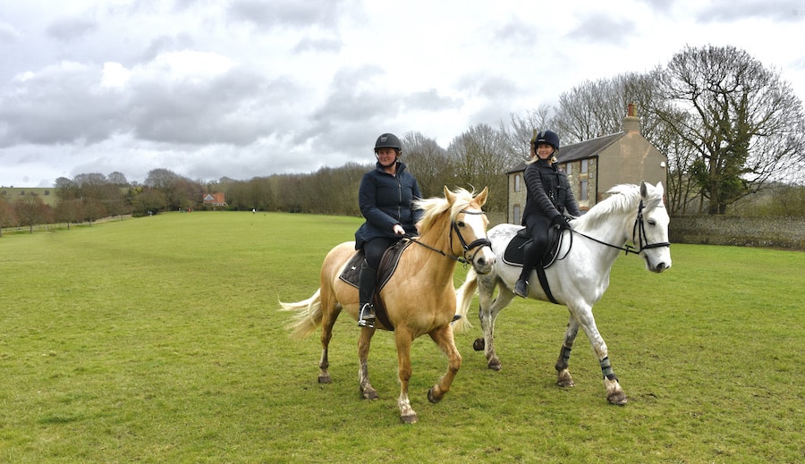
Horse riding and mountain biking around Arundel
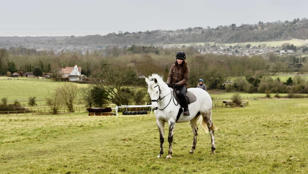
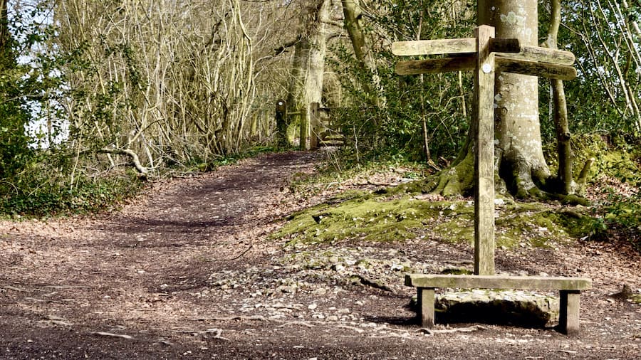
In this part of Sussex, we are so fortunate to be surrounded by a vast network of bridleways. These public paths are for the use of horse riders and mountain bikers – and, of course, walkers too.
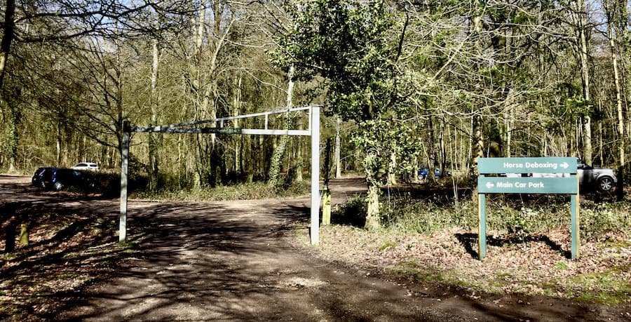
Read on for our guide to the best rides around Arundel and the local area. For each ride, we have included car park information suitable for cars and equestrian vehicles. Each of the routes below will take you an hour or two – depending on how fast you go!
On the South Downs National Park (SDNP) website, you can find a helpful overview of equestrian vehicle parking areas:
https://www.southdowns.gov.uk/wp-content/uploads/2019/04/Horsebox_2020-final.pdf


‘Lift up your hearts’ on the Eartham Woods ride
Eartham Woods are just north of Aldingbourne, off the A27. You will find the car park about a mile and a half north of the village. If you use this car park, reached down a quiet road, as your starting point you can choose from an abundance of excellent riding routes. Don’t worry about the height barrier; there is a designated area for the exclusive use of horseboxes and trailers just by the car park entrance.
This suggested route is approximately 6 miles and will take you along Stane Street and through Gumber. Leave the car park, heading south-east along the lane for a few yards, then take the first bridleway on your left. This is Stane Street, which was once part of the Roman road from Chichester to London. Continue through the woodland for about a mile, and then the track will take you onto open downland. At this point in the ride, look out for the raised embankment, also known as an agger, the traces left of the former Roman road. From here, you can enjoy fantastic views towards the coast. You can even see the spire of Chichester Cathedral. Follow the path straight for about half a mile, and you will pass Gumber Farm on your right.
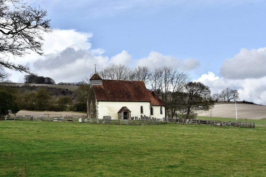
Hilaire Belloc (1870-1953), the writer and poet, was a frequent visitor to Gumber Farm and the South Downs. He was bought up in nearby Slindon, and there is a blue plaque in his memory on the bothy wall at Gumber. The plaque inscription reads, ‘Lift up your hearts in Gumber,’ which is from his poem:
Lift up your hearts in Gumber, laugh the Weald
And you my mother the Valley of Arun sing.
Here am I homeward from my wandering
Here am I homeward and my heart is healed.
In World War II, Gumber was also the site of a ‘dummy’ aerodrome, and you can still make out the foundations and footings of the buildings.
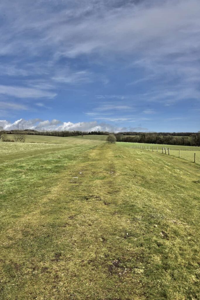
Once past Gumber Farm, stay on Stane Street and take the second bridleway on the right through a small wood. After just a few hundred yards, take the next bridleway on the right. This is known as Gumber Corner. The bridleway heads due south, and after passing through a gate, the track opens out into a beautiful piece of downland known as Great Down. While on this path, take time to enjoy the spectacular view in front of you towards the coast.
Another gate takes you onto Little Down and after entering a small area of woodland at the bottom, take a sharp right onto a bridleway that heads north for a few yards. Then take the next bridleway on your left, which goes across an open field for about half a mile, then alongside woodland onto a lane. Stay on this lane for a few hundred yards and take the first bridleway on the left. Carry on along this track, and when it forks, make sure you stay on the left track. Follow this bridleway, take the next path on your left and keep on that track until you get back to the lane, which only a few yards from where you started.
Enjoy sweeping coastal views on the Findon Village ride.
About 5 miles north of Worthing, Findon Village is the starting point for this stunning 8-mile ride. You can park at Nepcote Green, famous for its centuries-old annual sheep fair, on the slightly sloping surface just on the roadside at the northeast end of the Green.
If you are towing a trailer, it is best to arrive early as the parking area gets busy and could make manoeuvring hard. You can access the bridleway from the car park. There is a huge variety of circular routes to choose. We have picked one that will take you along part of the South Downs Way to see the Chanctonbury Ring.
From the Nepcote Green parking area, take the bridleway next to the house through a gate. You will see the racehorse training gallops on your right. If you arrive early enough, you might even see horses on the gallops or jumping the schooling fences. After a few yards, take the bridleway on the right and head eastwards until you reach the top of the training gallops. Go straight across the gallops and head east.
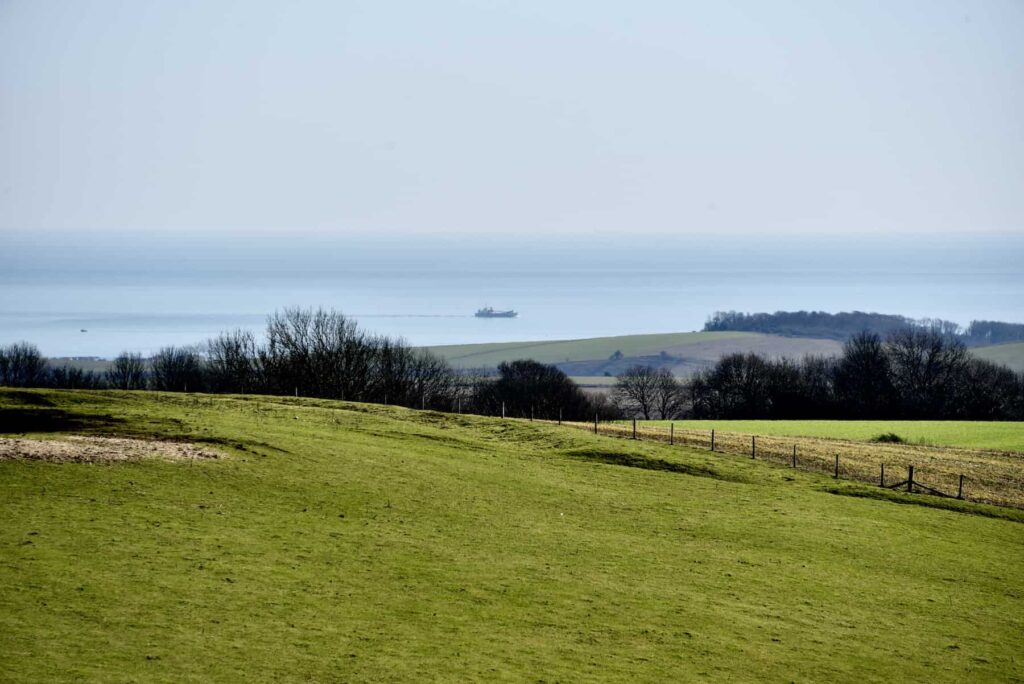
This bridleway was the old coaching road from Steyning to Arundel. The track goes downhill and then steeply uphill. At the top of this hill, you will see a memorial for a local farmer, Mr Langmead and his wife. It was built here because the view across the land he farmed is spectacular. On a clear day, you can see as far as Eastbourne in the east. If you look south, you might make out the majestic outline of Cissbury Ring, the Iron Age fort with its ramparts and famous flint mines. You can clearly see the English Channel from here. You will often be able to spot big container ships on their way to the port at Shoreham, taking care to avoid a different kind of farm – the offshore Rampion Wind Farm with its 116 electricity-generating turbines.
Turn left past the memorial, and you join the South Downs Way. Stay on this track for about two and a half miles, and after going through a gate next to a cattle grid, you will arrive at Chanctonbury Ring. Once the Roman temple site, in 1588, a beacon was lit here to warn of the Spanish Armada. Sadly, the original trees planted in 1760 by Charles Goring, who lived in Wiston House just below Chanctonbury, were severely damaged in the October 1987 ‘Great Storm’. Thanks to replanting after this devastation, the Ring is now returning to its former glory.
Charles Goring wrote a lovely poem about the trees he planted:
How oft around thy Ring, sweet hill
A boy, I used to play
And form my plans to plant thy top
On some auspicious day…… And then an almost hopeless wish
Would creep within my breast,
Oh! could I live to see thy top
In all it’s beauty dress’dThat time’s arrived; I’ve had my wish
And lived to eighty-five;
I’ll thank my God who gave such grace
As long as ere I live.
If you are on a horse, the Chanctonbury Ring is an ideal place for a canter as there is a large expanse of springy downland turf from one end to the other – perfect if you want to go up a gear or two! You will also be able to enjoy stunning views from the Ring towards the north across the Weald. The North Downs in Surrey are also easily visible from here.
On the west side of the ring is a downland dew pond. These were originally created to provide a watering hole for livestock. Nowadays, they are home to numerous creatures. This one at Chanctonbury, which you can ride right up to, is occupied by the rare great crested newt, and grass snakes have been seen swimming amongst the weed. The newts often swim up to the surface and can be easily seen in the spring if you watch closely enough.
Continue on the bridleway and take the south track. As you ride, enjoy the superb coastal views. Can you spot the Isle of Wight to the west? After about a mile, take the bridleway on the left, which goes downhill and round a left-hand bend. Shortly after, you will see an old cottage, called the Pest House, on your left. Pest houses were used to quarantine people who were suffering from diseases such as TB or smallpox. Findon’s pest house is one of only seven remaining in the UK.
After the Pest House, immediately turn right uphill onto a concrete track and then go through the gate in front of you and head across the field, coming out through another gate opposite. Go straight ahead, through Gallops Farm, turning left at the bottom of the farm road. Then take the first right, and you will be back to where you started at Nepcote Green.
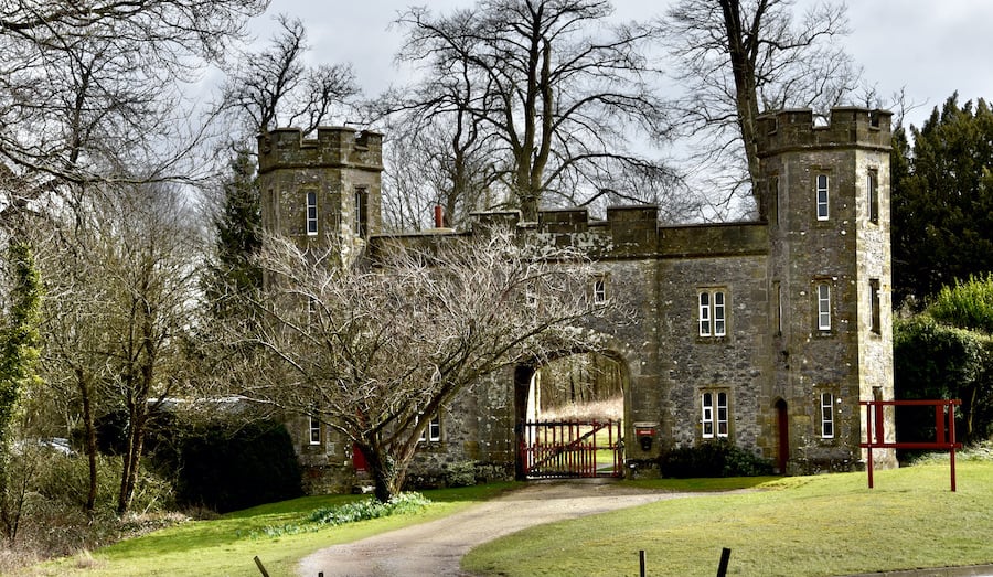
Follow in royal footsteps on the Whiteways Café ride
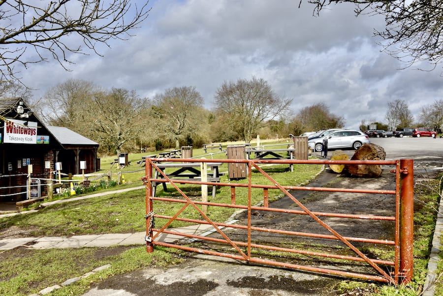
Whiteways café, on the A29/Bury Hill, northwest of Arundel, is a hugely popular starting point for rides and walks. It takes its name from the castellated lodge on the other side of the roundabout – Whiteways Lodge – which sits at a northern entrance to Arundel Park.
The car park is sizeable, and now Pay & Display, does get busy at weekends as it is a popular meeting spot for motorbike enthusiasts. Getting there early is an excellent idea. Water is available on site.
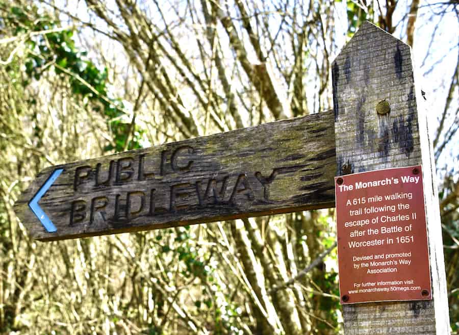
This 8-mile route will take you through Houghton Forest, up Bignor Hill and along part of the South Downs Way. Head west on the path known as the Monarch’s Way. Reputed to be King Charles II’s escape route after his 1651 defeat by Cromwell, the path runs all the way from Worcester to Shoreham.
At the top, take the left track staying on Monarch’s Way, which now becomes part of Stane Street, the old Roman road. After about two miles, follow the bridleway on the right into North Wood and take either the first or second bridleway on the right, both of which will bring you back up to the Monarch’s Way.
Before you turn, pause for a few moments to remember the 15 World War II airmen who were killed in two plane crashes when their aircraft came down near this spot at Upwaltham. In February 1944, a Lancaster bomber crashed with the loss of all its crew. A year later, a Dakota transport plane crashed a couple of miles away, again with the loss of all crew and passengers.
Look west across the road in front of you to the Upwaltham Church. If you want to visit this 900-year-old church, continue down the bridleway and cross over the road. Cardinal Manning, a previous incumbent, who went on to become Cardinal Archbishop of Westminster, described Upwaltham church and the Downs as ‘only less beautiful than heaven’. So, this Norman church is well worth a visit. On the wall, a plaque lists the names of the airmen who lost their lives nearby.
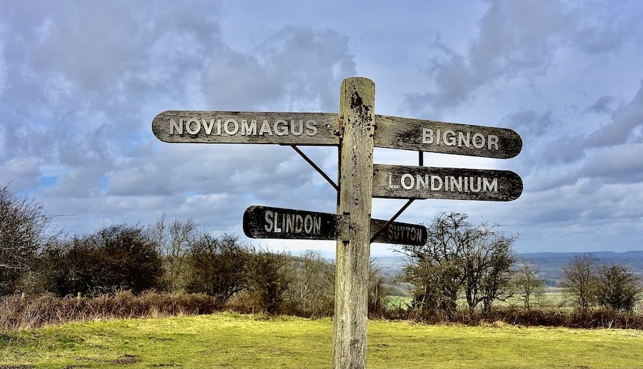
Head back up the bridleway to return to Monarch’s Way. Continue eastwards, and you will find yourself at the car park on the top of Bignor Hill. The views from here are amazing, and you will be able to capture a close-up view of the Bignor radio masts. This well-known local landmark can be seen from miles around. An old Celtic legend tells of the dragon that had its lair at the top of Bignor Hill and whose remains you can see today in the folds of the ground! Keep riding in the same direction and, after about half a mile, look northwards to the hamlet of Bignor, where a magnificent Roman villa once stood.
The villa was discovered by accident in 1811 when a farmer’s plough hit a large stone. A direct descendent of the man who made this significant discovery, also a farmer, still owns the site. Take a right onto the South Downs Way, and after about a mile and a half, turn right again along a bridleway, which runs almost parallel to the A29, Bury Hill. This will take you back to Whiteways, where you can get a well-deserved cup of tea at the café.
Written by Barb Hogan, Visit Arundel
Photos by Charlie Waring